[singlepic id=357 w=320 h=240 float=left]We finally decided to book the lodge on Thursday since the Yosemite is having a massive wild fire. When we arrived last night, the air quality was not bad.
We decided to go the little lake for the first day hike. The trail head is at mosquito flat, at rock creek where we stayed at the ledge a few years ago.
Soon I noticed the little lake area is very popular for hikers, backpackers. Not only the parking next to the trail head was completely full, but also the road sides were parked with cars. Finally we found a parking spot 2 miles away from the tail head.
The trail head locates as 10000ft high, start from Moskito flat at Rock creek. But the trail itself is pretty easy, no much up-downs, which is good for families with little kids. Also good for adjusting to the altitude before a bigger hike in this area.
[singlepic id=367 w=320 h=240 float=left]This trail might be the most beautiful one I’ve ever hiked in California. The view is gorgeous. The trail is next to a lovely creek with many beautiful lakes around. The meadow has some golden color and reminds me the scenary of yellow stone.
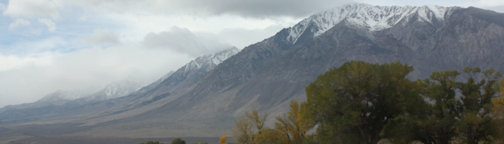
[singlepic id=371 w=320 h=240 float=left]The last photo is one of the panorama pictures taken with my iphone. Pretty awesome technology!
[singlepic id=370 w=320 h=240 float=left] On the way back I found some leaves turning into golder color already.
 It starts at camp site of switzs fall, the trail follows a creek all the way. Even it was a hot day, there’s still a good amount of water in the creek, together with many small waterfalls, pools nearby.
 It’s my first time to hike up San Jasinto. We started from trail head close to Idllywild. The sign shows 5.25mile but actually it was 13miles for the whole route, according to the GPS.