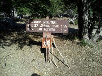
 It’s my first time to hike up San Jasinto. We started from trail head close to Idllywild. The sign shows 5.25mile but actually it was 13miles for the whole route, according to the GPS.
San Jasinto is the second highest peak in south California, therefore on the list of many hikers who are interested in challenging higher and more difficult peaks.
I loved the beautiful forest we walked through. At a point we meet hikers who came up from the tram. That’s another way to hike up San Jasinto peak.
The peak was full of people. Some people were so enthusiastic in taking photos there, we left the peak shortly to avoid the congestion.
The elevation gain was 4400 feet, the highest one I ever did this year. I will be back!
